
Written by Sig Silber
At the end of every month, NOAA issues an update to their Early Outlook for the following month, in this case, May 2020, which was issued as usual on the Third Thursday of the month. Today, fourteen days later, NOAA has issued their updated Outlook for May. The changes are fairly significant. With respect to temperature, the Great Lakes Area and the Northeast are now forecast to be cool but much of CONUS is forecast to have extreme heat. The precipitation pattern is harder to describe so it is easier to just look at the new versus prior precipitation forecast map. The net result, however, is somewhat more drought and clearly a different location for drought involving in particular northern New Mexico, The Texas Panhandle and part of Oklahoma, a small area in southwest Texas and eastern South Dakota.

Some housekeeping: On April 19, 2020, we published Part I of our analysis of the NOAA and JAMSTEC Three- to Four- Season Outlook and that can be accessed here. In that report, the May 2020 Early Outlook was issued. This article presents the NOAA update of their Early temperature and precipitation Outlook for May and the most recent Drought Forecast update for the month of May.
Please share this article – Go to the very top of the page, right-hand side for social media buttons. Also, feel free to send this article to anyone you feel will benefit from it. You can find the latest version of all our weather articles by consulting the Directory by clicking here and then clicking on the latest version of the article which is of interest to you.
Now let us address the NOAA Update of the May 2020 Forecast.
First, we will compare the NOAA Early Outlook for May 2020 with the newly issued update.
Early Outlook Temperature

Updated Temperature Outlook

Early Outlook Precipitation

Updated Precipitation

| April 16, 2020 Forecast for May 2020 | April 30, 2020, Forecast for May | |
| Temperature |
|
|
| Precipitation |
|
|
Here is the discussion released today:
Prognostic Discussion for Monthly Outlook NWS Climate Prediction Center College Park MD 300 PM EDT Thu Apr 30 2020
30-DAY OUTLOOK DISCUSSION FOR MAY 2020
The updated monthly temperature and precipitation outlooks for May 2020 are based on the latest dynamical model guidance, WPC temperature and precipitation forecasts during the first week of the month, the CPC 6-10/8-14 day temperature and precipitation outlooks, and climate linkages to current soil moisture. The enhanced phase of the Madden-Julian Oscillation (MJO) propagated east across Africa and the Indian Ocean during mid to late April. Despite the coherent, ongoing MJO and the likelihood of continued eastward propagation through early May, it is unclear how much influence the MJO will have on the mid-latitude circulation pattern. If the MJO continues to shift eastward over the Western Hemisphere, the large-scale environment would become favorable for tropical cyclone (TC) development in the East Pacific later in May and perhaps the Gulf of Mexico heading into June. Please refer to CPC’s Global Tropics Hazards for updates on the MJO along with TC development forecasts. [GEI publishes that information daily and the easiest way to access that report is to refer to the Directory and select the Article that has LIVE in the title from the top of the stack. The graphics in this article are automatically auto-updated in real time and we update the NOAA discussion twice a day. Farther down in the article there are graphics (sometimes smaller than we would like) that will show in real time NOAA warnings which you can click on to find more detailed information. It may well be the most detailed source for such information available as we have consolidated a number of different NOAA and other sources of information in one place. Use it as it can save you life].
Dynamical model forecasts are in excellent agreement for this time of year and feature a high amplitude ridge (trough) over western (eastern) North America during the first two weeks of May. This highly amplified ridge aloft increases chances of above normal temperatures throughout the West extending to the central and southern Great Plains. The largest probabilities (70 percent or more) of above normal temperatures are forecast across the Southwest due to anomalous heat likely to begin the month and also long-term trends . Rapidly drying topsoil supports those large probabilities extending east to the southern High Plains. An area of increased chances of below normal temperatures was added to the Great Lakes, eastern Corn Belt, and parts of the Northeast due to a persistent and highly amplified upper-level trough early in the month. Week 3-4 tools such as the CFS and ECMWF (initialized on Apr 27) suggest that temperatures across these areas would moderate or even transition to warmer-than-normal during the latter half of May. Equal chances of below, near, or above normal temperatures extend from the northern Great Plains southeast to the southern Appalachians and Carolinas where temperatures are expected to be highly variable during the month. Although the amplified upper-level trough over eastern North America is expected to result in a period of near or below normal temperatures across Florida during early May, above normal temperatures remain the most likely outcome for the entire month, especially the southern half of the Peninsula.
The high amplitude ridge/trough pattern over North America, forecast during early May, is a complicating factor in the revised precipitation outlook. This longwave pattern is a relatively dry one for the CONUS, while the outlook (released on April 16) featured a broad area with elevated probabilities of above normal precipitation throughout much of the Great Plains, Mississippi Valley, and Southeast. Since there is likely to be at least a week of mostly dry weather across the northern half of the Great Plains and parts of the Southeast, the coverage of elevated probabilities of above normal precipitation was reduced. The Weeks 3-4 tools (as of Apr 27) along with the CFS monthly continue to support either near or above normal precipitation across the Gulf Coast States. The slightly elevated chances of above normal precipitation, centered across the Ozarks to the middle Mississippi Valley, is associated with predicted rainfall at the beginning of the month. During the second week of May, model guidance continues to trend towards a wetter solution from the upper Rio Grande Valley north into New Mexico as return flow from the western Gulf spreads northwest. Given that these areas are relatively dry this time of year, above normal precipitation is slightly favored for parts of the Big Bend of Texas and New Mexico. A wet start to the month and many of the precipitation tools support increased chances of above normal precipitation across the Northeast. Given that the first half of the month is likely to be quite dry with anomalous northerly flow, below normal precipitation is most likely across the Great Lakes and northwest Corn Belt. To the north of the dry climatological areas of the Southwest, below normal precipitation is favored across the Great Basin due in part to the persistent, upper-level ridging early in the month.
Although near to below normal temperatures are forecast to prevail across Alaska at the beginning of May, the high amplitude ridge is likely to result in the development of above normal temperatures by the second week of the month. Once this upper-level ridge establishes itself, it is expected to continue through at least mid-May. This persistent ridge aloft and good agreement among Weeks 3-4 tools support increased chances of above normal temperatures across Alaska. This evolving longwave pattern also elevates probabilities of below normal precipitation across western mainland Alaska.
Visual Consistency Testing.
It is useful to see how the full-month forecast fits with the set of partial-month forecasts that we have. These will continue to update in this article. It is important to remember that with the partial-month forecasts, we generally have about 25 days of the subsequent month to look at when we do this at the end of the month as we are doing now. It depends on what day of the week the month ends. So this month, which ended on a Thursday, we are missing a forecast that includes the last nine days of the month. So we are not in great shape for the visual consistency testing this month. On Friday, when we have almost the complete picture, we may update the commentary in this article. If you read the NOAA discussion carefully, we may not have the forecast that will be issued tomorrow but NOAA had access to many of the elements of that forecast when they produced their forecast maps and discussion. So the update we will provide tomorrow will be useful but it probably is not going to change things very much other than our understanding. But you never know since with weather things change quickly.
First Temperature
 |  |  |  |
| The new monthly forecast is to the right. Does it appear to be reflective of the four parts of the month for which we have forecasts? → |
| ↑ ← The Week 3 – 4 forecast was updated Friday April 24 so we may want to update the commentary when the Week 3 – 4 update is reissued on May 1, 2020. At this point, we have forecasts for 22 days of the 31 days in May and the fit looks pretty good. We will have somewhat more confidence when we see the new Week 3 – 4 forecast tomorrow. | |
And Precipitation
 |  |  |  |
The new monthly forecast is to the right. Does it appear to be reflective of the four parts of the month for which we have forecasts? → |
| ↑ ←The Week 3 – 4 forecast was updated Friday April 24 so we may want to update the commentary when the Week 3 – 4 update is reissued on May 1, 2020. At this point, we have forecasts for 22 days of the 31 days in May and the fit looks pretty good. | |
Because the end of the month forecast was issued on a Tuesday, we see no point in publishing the prior Week 3 – 4 Discussion as the monthly discussion is a lot more current.
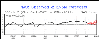
Even though the forecast discussion did not specificlaly mention the Arctic Oscillation (AO), I thought it useful to show the history and forecast of the AO.
Sometimes it is useful to compare the three-month outlook to the forecast for the first of the three months. It shows how much the pattern changes over the three-month period.

One can mentally subtract the First-Month Outlook from the Three-month Outlook and create the Outlook for the last two months in the three-month period.
And with respect to drought, this was also issued on April 30, 2020.

Tools used in the U.S. Monthly Drought Outlook (MDO) include the Climate Prediction Center (CPC) temperature and precipitation outlooks for May, various short- and medium-range forecasts and models such as the 7-day quantitative precipitation forecast (QPF) from the Weather Prediction Center (WPC), the 6-10 day and 8-14 day CPC extended-range forecasts (ERFs), the Weeks 3-4 outlooks and tools from CPC, dynamical models at the monthly time scale, the 384-hour total precipitation forecasts from several runs of the GFS, and May climatology. Initial conditions are based on the April 28, 2020 U.S. Drought Monitor. ENSO-neutral conditions are present, and are favored to continue at least through May 2020.
During the last 30-days, precipitation amounts ranged from less than a quarter-inch across the climatologically arid areas of the Southwest and in the rain shadow of the Washington Cascades, to 5-10 inches or greater (liquid equivalent) over the elevated terrain of the Cascades, Coastal Ranges, and Sierras. From a Percent of Normal Precipitation (PNP) perspective, the amount of precipitation that fell across much of the West registered below the historical 25th percentile. In contrast, the southeastern half of California had PNP values which spanned 125-400 percent of normal (or more) during the past 30-days. Since the start of the current Water Year (October 1, 2019), PNP values for much of the West varied between 25-75%. Only a few scattered locations reported PNP values that fell within the lowest quartile of the historical distribution. Most of the remainder of the western region (namely the Desert Southwest, central and southern New Mexico, and a significant portion of the northern and central High Plains reported PNP surpluses of 110-300 percent. As of April 29th, the basin-averaged Snow Water Content (SWC) varied widely across the West, with New Mexico, most of Oregon, California, south-central Idaho, and most of Nevada reporting below average SWC, and in some cases, below the 50th percentile. Most other SNOTEL reporting sites across the West indicated SWC’s were near to above average, with SWC values of 90-152% of normal.
May climatology favors the end of the rainy season and the beginning of the dry season for the West. The precipitation outlooks for week-1, week-2, and the monthly update for May, favor below normal precipitation (or Equal Chances of below, near, and above normal precipitation) for most areas of the West. The tilt in the odds towards above normal rainfall in the vicinity of New Mexico during week-2 is related to weak upslope flow in advance of a southern stream trough. At this time of year, it does not take much rain to bring about above normal precipitation in this region. Based on these considerations, persistence of drought is considered the most likely outcome.
Forecast confidence for the West is moderate to high.
During the last 30-days, moderate precipitation (0.5-2.0 inches) fell over most of the High Plains region. Heavy precipitation (2-4 inches, locally greater) was observed in eastern Kansas. Departure from Normal Precipitation (DNP) ranged from 1-2 inch deficits during the past 30-days for much of Kansas, Nebraska, and eastern South Dakota. In contrast, eastern North Dakota, and the eastern foothills of the Rockies in Montana and Wyoming observed surpluses of 0.5-2.0 inches. In the past 14-days, precipitation amounts were generally light (0.5-inch or less) over the northern Plains, and moderate (0.5-2.0 inches) over the central Plains, with eastern Kansas receiving the most precipitation during the past two weeks, between 2-4 inches. Soil moisture anomaly values in South Dakota, Nebraska, and northwestern Kansas have decreased by 1-2 inches since the beginning of April. USGS below normal 28-day average streamflow compared to historical streamflow for April 29th highlights low stream flows for the North Platte River in southwest Nebraska, and the Cimarron River in southwest Kansas.
The month of May is climatologically a wet time of year for the High Plains region. During week-1, anywhere from a quarter-inch to one-inch of precipitation is forecast across this region, likely due to passing fronts and large thunderstorm clusters. In week-2, near to below normal precipitation is expected. The updated monthly precipitation outlook for May calls for a tilt towards EC. This region has trended drier (especially after an extended wet period), and the latest U.S. Drought Monitor has introduced D0 (abnormal dryness) into this area. Relatively cool conditions and low evapotranspiration rates have helped delay the onset of dryness/drought. Remote sensing and other data sources have not adequately captured the true dryness of shallow soils in this region. The Dakotas are approaching a “tipping point”, whereby if insufficient rainfall is observed within the next few weeks, and if temperatures end up being warmer than forecast, this area could easily slide into a flash drought. Given the 30-day rainfall deficits, soil moisture decreases, precipitation outlooks for the next few weeks to a month in advance, and subseasonal SPI-3 forecasts that suggest dryness is likely to last through May, an area of drought development was introduced on the map in the vicinity of eastern South Dakota.
Forecast confidence for the High Plains region is low.
Across the Midwestern states during the last 30-days, the heaviest precipitation generally fell over the southern half of the region, with 5-6 inch totals observed in southwestern Missouri, extreme southeast portions of Ohio and Kentucky, and parts of west-central Illinois. Two to four inches of precipitation was reported across the remainder of the southern half of the Midwest region, with lesser amounts to the north (especially the Upper Mississippi Valley). Precipitation surpluses resulted from the heavy rainfall across the southern areas (DNPs ranged from 0.5-2.0 inches), during the past 30-days. In contrast, deficits of 1-3 (locally greater) inches were noted in much of the remainder of the Midwest region. Areas that have the larger deficits include northern and western Iowa, much of Indiana, southern Wisconsin, and far southern Illinois. Rain that fell within the past 14-days helped to offset these larger deficits in Indiana and southern Illinois, but did little to offset the deficits in Iowa and southern Wisconsin. Soil moisture anomaly values have decreased by 1-2 inches over much of the Midwest since the beginning of April. USGS 28-day average streamflow compared to historical streamflow for April 28th depicts near to above average flows for most of this region, with only scattered pockets of below average streamflow in extreme western Kentucky, Indiana, and Lower Michigan.
The month of May is typically a wet time of year across the Midwest, for the same reasons as noted for the High Plains region; frontal systems and thunderstorm complexes. Precipitation outlooks from week-1 to a month in advance favor relatively dry conditions over Minnesota, Iowa, Wisconsin, and Lower Michigan, with somewhat wetter conditions predicted elsewhere. Two factors that could delay the onset of dryness/drought in these more northern states include persistent cooler-than-normal temperatures and reduced evapotranspiration rates. For now, the best chance of drought development appears to be in neighboring eastern South Dakota.
Forecast confidence for the northern tier of the Midwest is low to moderate; and moderate for the rest of the Midwest.
During the last 30-days, excessive rain (5-10 inches, heavier in more localized regions) was widespread across most of the Lower Mississippi Valley, and the Tennessee Valley. This was associated with protracted periods of moist southerly flow from the Gulf, and storms either passing through or stalling across the region. Needless to say, rainfall surpluses were noted across a large portion of the South, though there were some exceptions. These exceptions included much of northern Texas and west-central Oklahoma, where 1-3 deficits were noted during the past 30-days. During the past two weeks, most of the South experienced moderate to heavy rainfall (0.5-inch or greater), with the exception of western and central portions of Texas. A state-by-state breakdown of preliminary severe weather reports from the Storm Prediction Center spanning April 1-27 shows 258 total storm reports in Texas (27 tornado reports, 136 hail reports, and 95 straight-line, high wind reports); for Oklahoma the respective numbers are 113/10/85/18; for Arkansas 108/4/35/69; for Louisiana 164/35/51/78; for Mississippi 236/57/32/147; and for Tennessee 59/5/13/41.
May precipitation climatology is generally favorable across the South, with near to above normal rainfall. Precipitation outlooks for week-1 to one month in advance do not favor significant relief for pre-existing drought areas along the Gulf Coast, even though the updated May precipitation outlook favors a slight tilt toward above normal precipitation. However, since 8am Tuesday (April 28th) morning, 2-6 inches of additional rainfall have fallen across much of this region, so improvement/removal of drought is warranted. The area where drought development is considered most likely includes western portions of Texas and Oklahoma, and part of New Mexico. This is based on predictions of above-average surface temperature and low precipitation totals, associated with a strong ridge aloft. The designated drought development areas are guided by the D0 (abnormal dryness) contours of the latest U.S. Drought Monitor.
Forecast confidence for the South is moderate.
Heavy rain (2 inches or greater) fell over most of the Southeast during the past month, with few exceptions. For the central and southern Appalachians, and most of Alabama and Georgia, rainfall amounts of 5-10 inches were reported (even greater amounts were observed in north-central Alabama and south-central Georgia). As expected, most of the Southeast had substantial precipitation surpluses during the past month, though there were a few very localized exceptions. Even though Florida started the month off dry (as is often the case during their mid-late dry season), the rain received in April was enough to result in a precipitation surplus for most of the Sunshine State. Much of the rain that fell across the Southeast during the last 30-days fell within the most recent two-week period.
Climatologically, May is a time of transition across Florida, from the dry season to the wet season. May climatology also favors a slight tilt toward dryness for most of Georgia. The week-1 rainfall outlook predicts light to moderate precipitation (less than 2 inches) for most of the Southeast region. Widespread near normal rainfall is forecast during week-2. The updated May 2020 precipitation outlook depicts Equal Chances (EC) of below, near, and above normal precipitation for most of the Southeast region, with the exception of Florida and much of Alabama which are modestly favored to receive above normal rainfall. A one-category improvement in drought status is predicted for the Southeast region (except for southern Florida), based in large part on heavy rain (2-6 inches) that has fallen since 8am Tuesday (April 28th). The forecast for southern Florida is substantially less confident, and drought persistence is deemed the better bet for that area.
Forecast confidence for the Southeast is low (Florida Peninsula) to moderate (remainder of Southeast region).
As was the case for the Southeast, the Northeast also had heavy precipitation (2-6 inches, somewhat greater near the New England Coast and the Virginias) during the past 30-days. With few exceptions, such as far northern New York state, the Northeast experienced significant precipitation surpluses during this period. More recently, during the past two weeks, the Northeast received moderate to heavy rainfall (0.5-3.0 inches).
The Northeast typically receives an adequate amount of rainfall in May from passing low pressure systems. Given favorable precipitation outlooks for the region, there is no reason to go with any drought development.
Forecast confidence for the Northeast is moderate to high.
In Hawaii, preliminary NWS month-to-date (MTD) rainfall measured at Honolulu totaled 2.55 inches; the normal is 0.60-inch, which resulted in a surplus of +1.95 inches. Since March 1st, the total was 6.31 inches, normal is 2.62 inches, and the result is a surplus of +3.69 inches for the period. Lihue’s respective numbers for the MTD period are (in inches) 1.89, 2.12, with a slight deficit of -0.23. Since March 1st, the rainfall values are 17.51, 6.73, and a very large resulting surplus of 10.78 inches. For Hilo, the respective numbers for the MTD period are 7.65, 10.90, and -3.25 inches. Since March 1st, the rainfall values are 35.60, 24.33, and a resulting excess of +11.27 inches. However, the Hawaiian rainy season is drawing to a close, so it will be more difficult for residual moderate drought (D1 on the U.S. Drought Monitor) on parts of Molokai, Kahoolawe, and the Big Island to be alleviated in May.
Forecast confidence for Hawaii is moderate during this month of general transition from wet to dry season.
In Alaska, preliminary NWS MTD precipitation (liquid equivalent) numbers for Anchorage (according to the pattern used above in the Hawaii section) were 0.90, 0.44, and a surplus of +0.46 inches. Since March 1st, 2.32 inches of precipitation were reported, with a normal of 1.04 inches. This resulted in a surplus of +1.28 inches. The MTD numbers for Fairbanks are 1.27, 0.28, with a surplus of +0.99 inches. Since March 1st, Fairbanks received 2.86 inches, which was well above the normal of 0.53 inches, resulting in a sizable surplus of +2.33 inches. Juneau’s MTD precipitation numbers are 4.66, 2.74, and +1.92 inches. The values since March 1st are unavailable at this time). There is no drought in Alaska at this time, and none is expected to develop in May.
Forecast confidence for Alaska is moderate.
In Puerto Rico, San Juan recorded 4.17 inches of rain since April 1st, which is a tenth of an inch shy of normal. Since March 1st, San Juan received a total of 9.12 inches, with a normal of 6.22 inches, resulting in a net surplus of +2.90 inches for the period. Although there is no drought in Puerto Rico at this time, there are two areas of abnormal dryness (D0 on the U.S. Drought Monitor) over the southern coast of Puerto Rico that need to be monitored.
Forecast confidence for Puerto Rico is moderate.
Looking back on April to relate the forecast for May to the actuals in April
First April Temperature (30 out of 31 days).

And then April Precipitation (30 out of 31 days).

We then show the new forecast and the prior month actuals (less one day) side by side.
| Prior Month (usually missing one day) | Forecast for current Month | |
| Temperature |
|
|
| Precipitation |
|
|


Conclusion
The purpose of this article was to present the updated Outlook for May 2020 and compare it with the Early Outlook. It is not to critique the updated Outlook for May based on our opinions but we point out possible inconsistencies if we find them. We have assessed the extent to which the monthly outlook seems to fit with the other forecasts provided by NOAA. In reality, all forecasts are obsolete when issued as the situation changes day by day or six hours by six hours i.e. each new model run. In our other articles, we continually examine the current forecasts from NOAA including the Day 1- 5, 6-10, 8-14 and Week 3 and 4. So we are continually looking at approximately 25 days into the future.
On May 14, 2020, IRI/CBC will issue their ENSO forecast and we will present that and critique it. It is an ongoing process and we attempt to provide our readers with the best current assessment of the next approximately 25 days (except when we cover the Four-Season Analysis or medium-frequency cycles such as ENSO), so our analysis is pretty much ongoing. We also publish a “LIVE” Weather Article which updates in real-time to reflect NOAA Weather Headlines and for those interested provides detailed information down to current warnings in place. All of our reports including past versions of these reports can be located via the Directory/Archive which can be accessed here.


