Written by Sig Silber
At the end of every month, NOAA issues an update to their Early Outlook for the following month, in this case, October, which was issued on the Third Thursday of the Month. Today, eleven days later, NOAA has issued the updated Outlook for October. It is a very substantial change.

Some housekeeping: On September 21, 2019 we published Part I of our analysis of the NOAA and JAMSTEC Three- to Four- Season Outlook and that can be accessed here. In that report, the October Early Outlook was issued. This article presents the NOAA update of their Early Outlook for October. Our regular Monday Night Intermediate-Term Forecast will be published Tuesday Night but actually, a summary of that forecast is in this article as part of the visual consistency testing process so you have a preview.
Please share this article – Go to the very top of the page, right-hand side for social media buttons. Also, feel free to send this article to anyone you feel will benefit from it. You can find the latest version of all our weather articles by consulting the Directory by clicking here and then clicking on the latest version of the article which is of interest to you.
Now let us address the NOAA Update of the October, 2019 Forecast.
A note about terminology; the deviations from climatology/normal are color-coded but also labeled “A” for more than (above) normal and “B” for less than (below) normal. The area designated EC means Equal Chances of being more or less than normal. In the Short Term forecasts, NOAA has switched from using EC to N for Normal. For most purposes, EC and N can be considered to mean about the same thing. “N” implies a bit more certainty that the variation from Normal/Climatology will be small compared to “EC”.
First, we will compare the NOAA Early Outlook for October, 2019 with the newly issued update.
Early Outlook Temperature

Updated Temperature Outlook

Early Outlook Precipitation

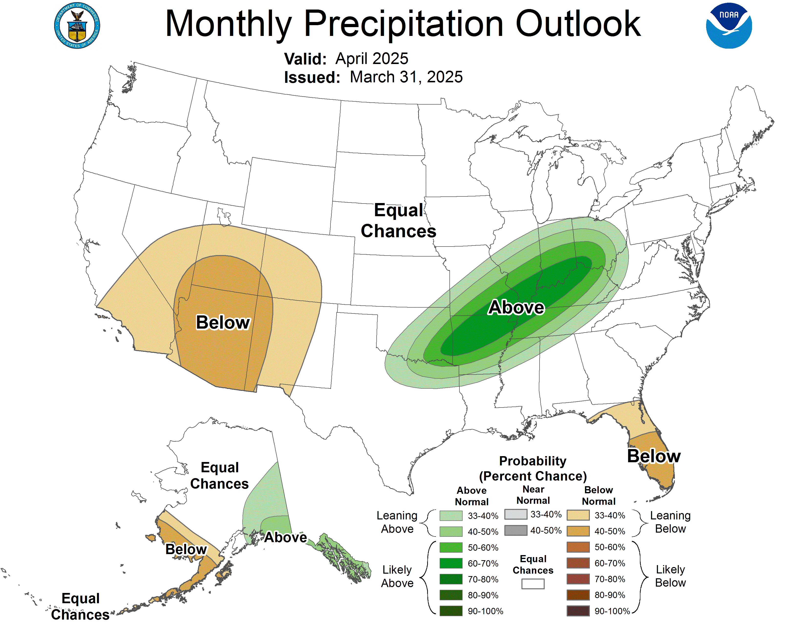
Updated Precipitation

| September 19, 2019 Forecast for October | September 30, 2019 Forecast for October | |
| Temperature | ||
| Precipitation |
The discussion released today with the new forecast is shown later in the article with the discussion related to the new drought forecast.
Visual Consistency Testing.
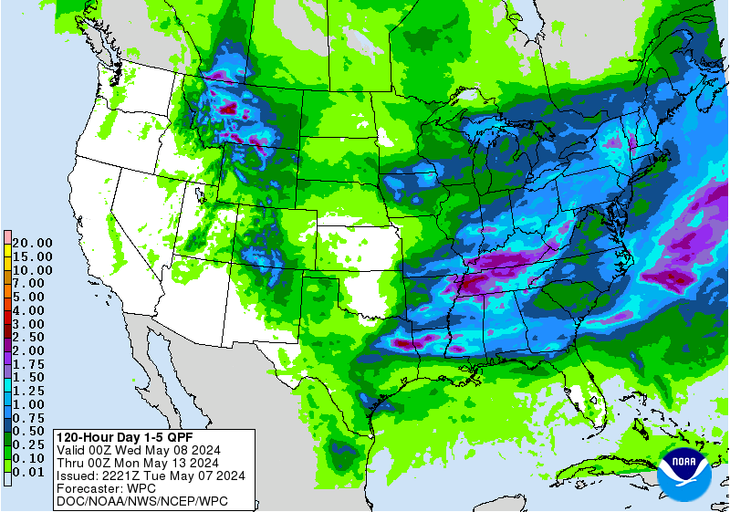
It is useful to see how the full month forecast fits with the set of shorter forecasts that we have. These will continue to update in this article. It is important to remember that of the short term forecasts, we generally have about 25 days of the subsequent month to look at when we do this at the end of the month as we are doing now so this month we do not have the last five days of the month represented by short-term forecasts.
First Temperature
And Precipitation
Sometimes it is useful to compare the three-month outlook to the forecast for the first of the three months. It shows how much the pattern changes over the three-month period.

One can mentally subtract the First-Month Outlook from the Three-month Outlook and create the Outlook for the last two months in the three-month period.
And with respect to drought, this was also issued on September 30, 2019.
Looking back on September to relate the forecast for October to the actuals in September.
First September Temperature (29 out of 30 days).
And then September Precipitation (29 out of 30 days).
We then show the new forecast and the prior month actuals (less one day) side by side.
| Prior Month (usually missing one day) | Forecast for current Month | |
| Temperature | ||
| Precipitation |
We now present the discussion released with the new October Outlook
30-DAY OUTLOOK DISCUSSION FOR OCTOBER 2019
The updated October 2019 temperature and precipitation outlook builds upon some of the factors outlined in the mid-September discussion below and is modified by the latest suite of dynamical model guidance from the short-range, medium-range, extended-range and complete monthly forecast integrations.
The start of October is anticipated to see an amplified pattern across the CONUS with a strong trough-ridge pattern oriented across the CONUS. Over the first 7 days or so, this pattern is favored to shift eastward, become less amplified and then make a transition to a more zonally oriented flow over the CONUS. During the second week of October, a warmer pattern is favored to develop for the eastern two-thirds and Southwest CONUS as a result of this more zonal oriented flow and increasing coverage of positive 500-hPa height departures along the southern tier and eastern CONUS. Residual troughing is favored to remain across the Pacific Northwest.
A number of factors point to elevated odds for above-normal temperatures for most of the CONUS for the second half of October. First, long term trends are positive in nearly all areas of the forecast domain, ongoing MJO activity favors above-normal temperatures for most of the central and eastern CONUS and Southeast Canada and Week 3-4 dynamical model guidance from the CFS, ECMWF and JMA favor above-normal temperatures for much of the second half of October. Also, short-term or regime based bias corrections (i.e., based on past 45 days) show that some model forecasts for below-normal temperatures across the CONUS have been overestimated to some degree.
Forecast of favored below-normal temperatures for October are focused over some areas of the Pacific Northwest to the northern High Plains. These depictions only show modest increases in odds as compared to climatology and are related to early in the month cold air intrusion during the first week of October that may potentially keep mean October temperature anomalies below the lower one-third of the historical range.
High odds for above-normal temperatures are depicted for the Southeast, lower Appalachians and lower mid-Atlantic – a result of nearly all information primarily pointing to above-normal temperatures and also where flash drought conditions are ongoing and favored to continue to deteriorate during the first 10 days of October.
The updated October precipitation outlook is able to increase forecast coverage from very low areal numbers released in the mid-September initial outlook. The general themes, to first order, are maintained with the forecast coverage for above-normal precipitation depicted in the initial outlook along the northern tier of the CONUS increased with modest odds depicted for the Pacific Northwest and Northeast and greater probabilities depicted over the northern Plains, upper Mississippi Valley and western Great Lakes. This area of favored above-normal precipitation is extended southward in the updated outlook as a plume of moisture from the sub Tropics is likely to spread northward and eastward around anticipated ridging located over the Southeast and then interact with troughing and the general westerlies along the Canadian border.
Above-normal precipitation remains most likely for areas of the Southwest associated with potential influence from eastern Pacific tropical disturbances or cyclones that may increase moisture at times during the month. These odds are on modestly increased from climatology.
Forecast guidance for the first week in October indicates very little precipitation for much of the Southeast from Texas to the lower Atlantic seaboard. Week 3-4 forecast tools, long term trends and MJO impacts do not indicate with any consistency or reliability, robust signatures for above-normal precipitation during the second half of October. Based on this combined information below-normal precipitation is depicted for this region. Elevated odds for above-normal precipitation remain forecast for parts of the Florida Peninsula, however. There is high uncertainty for Alaska so the initial outlook was modified to now favor enhanced odds for above-normal precipitation for the west coast of Alaska.
and the discussion released with the new Drought Forecast
Latest Monthly Assessment –
Rapid drought development and intensification occurred this past month across much of the Southeast, central to southern Appalachians, and the Ohio and Tennessee Valleys. This “flash drought” was a result of sparse rainfall (less than an inch) coupled with abnormal heat (30-day temperatures averaging 3 to 6 degrees F above normal). According to the U.S. Drought Monitor valid on September 24, moderate drought (D1) coverage increased from 6.97 to 56.2 percent, 0.37 to 60.76 percent, and 0 to 58.67 percent across Georgia, Tennessee, and Kentucky, respectively, during the past four weeks. The increase in drought coverage throughout the continental United States nearly doubled from 9.07 to 17.37 percent from late August. Parts of the lower Mississippi Valley, Texas, and the Southwest also experienced drought development and intensification. Conversely, drought recently ended across much of the Pacific Northwest. Although long-term drought persists along the Alaska Panhandle, the seasonal increase in precipitation brought drought relief to southern mainland Alaska.
A dry start to the month along with a continuation of above normal temperatures is likely to result in additional drought expansion across the Southeast, mid-Atlantic, lower Mississippi Valley, and Texas. Prospects for removal increase closer to the Great Lakes, based on the predicted mid-latitude storm track. Forecast rainfall amounts during the first week of October support removal of short-term drought across parts of southwest Kansas, western Oklahoma, the Texas Panhandle, and southeast New Mexico. Broad scale persistence is forecast across the Southwest where 2019 monsoon rainfall was below normal. Drought is forecast to slightly expand across southern Utah and southwest Colorado. Recent drought removal is forecast to continue through October across the Pacific Northwest and the northern Rockies, based on an increasingly wet climatology.
A wet climatology also supports continued short-term drought removal or improvement across southern mainland Alaska during the next month. However, persistence is forecast for the longer term drought in the Alaska Panhandle. Based on the lack of a strong wet signal, persistence is most likely across southern Puerto Rico. Since early to mid-October is forecast to remain relatively wet, continued improvement or remvoal is forecast for Hawaii.
Summary
The purpose of this article was to present the updated Outlook for October, 2019 and compare it with the Early Outlook. It is not to critique the updated Outlook for October based on our opinions but we point out possible inconsistencies if we find them. We have assessed the extent to which the monthly outlook seems to fit with the other forecasts provided by NOAA. We do not have an October forecast by JAMSTEC as they only provide three-month forecasts. In reality, all forecasts are obsolete when issued as the situation changes day by day or six hours by six hours i.e. each new model run. In our other articles, we continually examine the current forecasts from NOAA including the Day 1- 5, 6-10, 8-14 and Week 3 and 4. So we are continually looking at approximately 25 days into the future.
On October 10, 2019, IRI/CBC will issue their ENSO forecast and we will present that and critique it. It is an ongoing process and we attempt to provide our readers with the best current assessment of the next approximately 25 days (except when we cover the Four-Season Analysis or medium-frequency cycles such as ENSO), so our analysis is pretty much ongoing. We also publish a Live Severe Weather Article which updates in real-time to reflect NOAA Weather Headlines. All of our reports including past versions of these reports can be located via the Directory/Archive which can be accessed here.


