Written by Sig Silber
On November 17, NOAA released their Seasonal Outlook. NOAA is all in on La Nina determining our weather but the dynamic forecast models are not in sync with the statistical models that are based on historical La Nina’s . The wild card is the Arctic Oscillation (AO) which could make the East Coast and Europe feel like Siberia (Alaska is unusually warm right now).

Last week, JAMSTEC, which is a Japanese Research Institute, issued their Outlook based on their November 1 forecast for ENSO. We compare the JAMSTEC temperature and precipitation forecast maps which are for the World with the NOAA temperature and precipitation forecast maps that cover only CONUS and Alaska. We do this primarily for educational purposes. Remember: these are forecasts not guarantees. But the differences between the NOAA and JAMSTEC forecasts are significant and mostly related to the differing perspectives on the strength and duration of this Cool ENSO Event
Some Housekeeping Issues
This report will be posted Saturday November 19 and will be referred to in the Weekly Report for reference until the Saturday after the next NOAA Update on December 15. The Regular Weekly Report will be published on November 21. If you are reading this Update Report and wish to transfer to the Current Weather and Climate Report, Click here for the list of Weather Posts. That link takes you to the archive of all weather articles written by Sig Silber so you can if the new Weekly Weather Report has been published go there or back to an earlier report but please keep in mind that the graphics in earlier reports in some case auto-update and the text may no longer apply to the graphics shown. Remember, if you leave this page to visit links provided in this article, you can return by hitting your “Back Arrow”, usually top left corner of your screen just to the left of the URL box.
NOAA Updated Seasonal Outlook
NOAA issued their updated Seasonal Outlook on the third Thursday of the month i.e. November 17, 2016 as is their normal schedule. Let’s take a look.
Temperature

Precipitation

Now we consider the three-month Outlook.
Prior Temperature Outlook for DJF 2016

New Temperature Outlook for DJF 2016

Prior Precipitation Outlook for DJF 2016

New Precipitation Outlook for DJF 2016

Now let us focus on the long-term situation and compare the new set of maps with the maps issued on September 15, 2016.
Prior 14 Month Temperature Outlook: DJF 2016 – NDJ 2017/2018

New 14 Month Temperature Outlook: JFM 2017 – DJF 2017/2018

To compare maps from one release to another one needs to remember that the new release drops one three-month period and adds a later one. So to make the comparisons one has to shift the new maps to the right one position and that makes the map on the right drop down to become the left-most map in the next level. I do not have a computer software tool for doing that for you so you have to do it mentally. When I do the comparison, I print the two sets of maps and put them side by side and number the same three-month maps 1, 2, 3,…..,11 in both sets of maps to make it easier for me to easily compare the same three-month period in the new with the previous forecast. One uses the same procedure to compare the precipitation maps. Based on this procedure, I conclude that:
Prior 14 Month Precipitation Outlook: DJF 2016 – NDJ 2017/2018

New 14 Month Precipitation Outlook: JFM 2017 – DJF 2017/2018

If you want larger versions of each map (temperature and precipitation) you can find them here. And each of those maps can be clicked on to further enlarge them.
Sometimes it is useful to compare the present month outlook to the three-month outlook

One can mentally subtract the December Outlook from the three-month Outlook and create the Outlook for the last two months in the three-month period namely January and February 2017. When I do that, I deduce that:
Below are excerpts (significantly reorganized and with a lot of the redundancy removed) from the Discussion released by NOAA on November 17, 2016. Headings that are “Initial Cap” only rather than all caps were added by the Author of this Update Report for clarity. Also we have organized the sequence of the sections of NOAA Discussion to first present the Atmospheric Conditions and then the Current Month, the Three or Four-month period, and finally the remainder of the 15 Month Forecast. We think that sequence with the three- to four-month period broken out separately, makes the discussion more useful for more readers.
CURRENT ATMOSPHERIC AND OCEANIC CONDITIONS
IN THE TROPICAL PACIFIC, BOTH OCEANIC AND ATMOSPHERIC OBSERVATIONAL INDICATORS (ON AVERAGE) INDICATE LA NINA CONDITIONS, THOUGH THE TRADE WINDS REMAIN NEAR NORMAL ON AVERAGE. [Editor’s Note: Normally a reason not to conclude that La Nina conditions exist]
SEA SURFACE TEMPERATURES (SSTS) ALONG THE EQUATOR IN THE PACIFIC BASIN REMAIN BELOW AVERAGE FROM 180W TO 100W, WHILE SSTS ARE ABOVE AVERAGE ACROSS THE FAR WESTERN PACIFIC AND IN A HORSESHOE PATTERN NORTH AND SOUTH OF THE AREA OF COOLER THAN NORMAL SSTS ALONG THE EQUATOR. IN THE NINO-3.4 REGION, THE MOST RECENT WEEKLY ANOMALY VALUE IS -0.7 DEGREES C WHILE THE MOST RECENT THREE-MONTH AVERAGE NINO-3.4 SST ANOMALY IS -0.7 DEGREES C FOR THE ASO SEASON. A RESERVOIR OF ANOMALOUSLY COOL SUBSURFACE WATERS CONTINUES AT DEPTH AND EXTENDS TO MORE THAN 150 METERS BELOW THE SURFACE, WITH THE LARGEST NEGATIVE ANOMALIES OF 2-4 DEGREES C BELOW AVERAGE FROM 100-150 METERS CENTERED NEAR 140W.
OVER THE PAST SEVERAL WEEKS, ENHANCED CONVECTION HAS BEEN CENTERED OVER THE MARITIME CONTINENT, WITH SUPPRESSED CONVECTION EXTENDING EASTWARD FROM 160E ACROSS MUCH OF THE EQUATORIAL PACIFIC. RECENTLY, HOWEVER, SUBSEASONAL VARIABILITY HAS DISRUPTED THIS PATTERN AND LED TO DRYING ACROSS PARTS OF THE MARITIME CONTINENT AND EASTERN INDIAN OCEAN. TRADE WINDS OVER THE PAST MONTH HAVE BEEN NEAR AVERAGE.
SSTS IN THE NORTHEAST PACIFIC AND ALONG THE COAST OF ALASKA REMAIN ABOVE AVERAGE, ALTHOUGH THE ATMOSPHERIC CIRCULATION HAS FORCED A DRAMATIC COOLING OVER THE NORTH-CENTRAL PACIFIC BASIN. POSITIVE SST ANOMALIES PERSIST IN THE WESTERN ATLANTIC NEAR THE U.S. EAST COAST, AND THE GULF OF MEXICO.
PROGNOSTIC DISCUSSION OF SST FORECASTS
THE CPC SST CONSOLIDATION FORECAST, WHICH INCLUDES THREE STATISTICAL FORECASTS ALONG WITH THE CFS, PREDICTS A WEAK LA NINA DURING DJF 2016-2017 WITH ENSO-NEUTRAL CONDITIONS FAVORED THEREAFTER. BY WINTER 2017-2018, THE CONSOLIDATION FAVORS LA NINA OVER EL NINO. THE NORTH AMERICAN MULTI MODEL ENSEMBLE (NMME) ENSEMBLE MEAN FORECAST FOR THE NINO-3.4 SST ANOMALY IS SLIGHTLY WARMER THAN LAST MONTH, WITH ENSO-NEUTRAL FAVORED EARLY IN OUTLOOK PERIOD. BASED ON THE LATEST OBSERVATIONAL AND MODEL FORECAST INDICATORS, THE OFFICIAL CPC/IRI ENSO OUTLOOK FAVORS LA NINA CONDITIONS AT 55% DURING DJF 2016-2017, THE SAME PROBABILITY THAT WAS ISSUED LAST MONTH. [Editor’s Note: Then why was the ENSO Status changed?]
PROGNOSTIC TOOLS USED FOR U.S. TEMPERATURE AND PRECIPITATION OUTLOOKS
THE SUBSEQUENT TEMPERATURE AND PRECIPITATION OUTLOOKS CONSIDERED LA NINA REGRESSIONS, STATISTICAL TOOLS, SUCH AS REGRESSIONS BASED ON THE CPC CONSOLIDATED SST FORECAST, A CONSTRUCTED ANALOG BASED ON GLOBAL SST ANOMALY PATTERNS, AND CANONICAL CORRELATION ANALYSIS THAT USES THE EVOLUTION OF SST AND SEA-LEVEL PRESSURE AS PREDICTORS. ALSO CONSIDERED WERE THE CALIBRATED PROBABILISTIC FORECASTS FROM THE NMME, GUIDANCE FROM PARTICIPANT MODELS OF THE INTERNATIONAL MULTI-MODEL ENSEMBLE (IMME) AND THE CPC CONSOLIDATION (CPC CON) FORECAST. OTHER FACTORS INCLUDED POTENTIAL INFLUENCE FROM MORE LOCAL, COASTAL SSTS.
30-DAY OUTLOOK DISCUSSION FOR DECEMBER 2016
THE DECEMBER 2016 TEMPERATURE AND PRECIPITATION OUTLOOKS ARE BASED ON DYNAMICAL MODEL GUIDANCE, STATISTICAL TOOLS, AND THE TYPICAL INFLUENCE FROM LA NINA. DURING THE PAST COUPLE OF MONTHS, LA NINA CONDITIONS DEVELOPED AS OBSERVED WITH NEGATIVE SEA SURFACE TEMPERATURES ACROSS THE EASTERN AND CENTRAL EQUATORIAL PACIFIC OCEAN ALONG WITH SUPPRESSED (ENHANCED) CONVECTION ACROSS THE CENTRAL TROPICAL PACIFIC (INDONESIA). CLIMATE SIGNALS TYPICALLY ASSOCIATED WITH LA NINA WERE CONSIDERED IN MAKING THE DECEMBER 2016 OUTLOOK, GIVEN THESE CURRENT ATMOSPHERIC AND OCEANIC STATES.
ALTHOUGH THE MJO STRENGTHENED DURING EARLY NOVEMBER, ITS EFFECTS ON THE EXTRATROPICS ARE UNCLEAR DUE TO INTERFERENCE WITH THE LOW FREQUENCY BASE STATE. THE DYNAMICAL MODELS INDICATE A DECREASE IN THE AMPLITUDE OF THE MJO SIGNAL DURING THE NEXT WEEK. THEREFORE, THE MJO DID NOT FACTOR INTO THE DECEMBER OUTLOOK. ITS EVOLUTION WILL BE CLOSELY MONITORED FOR THE REVISED OUTLOOK AT THE END OF NOVEMBER.
Temperature
DESPITE EXCELLENT AGREEMENT AMONG THE DYNAMICAL MODELS THAT FAVOR ABOVE-NORMAL TEMPERATURES THROUGHOUT THE FORECAST DOMAIN, FORECAST CONFIDENCE IN THE TEMPERATURE OUTLOOK IS LOWER THAN WOULD BE EXPECTED. THE ARCTIC OSCILLATION (AO) INDEX HAD ONE ITS MOST NEGATIVE VALUES FOR OCTOBER. A NEGATIVE AO INDEX IS ASSOCIATED WITH ABOVE (BELOW) NORMAL 500-HPA HEIGHTS AT THE HIGHER (MIDDLE) LATITUDES OF THE NORTHERN HEMISPHERE. THIS PATTERN RESULTED IN BELOW-NORMAL TEMPERATURES ACROSS PARTS OF EURASIA. HOWEVER, ABOVE-NORMAL TEMPERATURES WERE OBSERVED ACROSS MOST OF THE LOWER 48 DURING OCTOBER. AFTER A BRIEF PERIOD WITH A POSITIVE AO INDEX, THE GFS MODEL REMAINS CONSISTENT THAT THE AO INDEX BECOMES SHARPLY NEGATIVE ONCE AGAIN DURING LATE NOVEMBER. BELOW-NORMAL TEMPERATURES ARE TYPICALLY ASSOCIATED WITH A NEGATIVE AO INDEX FROM THE NORTHERN GREAT PLAINS SOUTHEAST TO THE SOUTHERN ATLANTIC COASTAL STATES DURING DECEMBER. GIVEN THE LARGE DISAGREEMENT BETWEEN TEMPERATURE COMPOSITES OF A NEGATIVE AO INDEX (BELOW NORMAL) AND DYNAMICAL MODEL GUIDANCE (ABOVE NORMAL), EQUAL CHANCES FOR BELOW, NEAR, OR ABOVE-NORMAL TEMPERATURES ARE FORECAST FROM THE NORTHERN GREAT PLAINS EXTENDING INTO THE SOUTHEAST. ELSEWHERE, ABOVE-NORMAL TEMPERATURES ARE FAVORED ACROSS NEW ENGLAND AND THE WESTERN CONUS ALTHOUGH PROBABILITIES ARE TEMPERED DUE TO THE BLOCKY 500-HPA PATTERN OVER THE NORTHERN HEMISPHERE EXPECTED AT THE BEGINNING OF DECEMBER.
Precipitation
THE PRECIPITATION OUTLOOK FOR DECEMBER IS BASED PRIMARILY ON THE CALIBRATED NMME AND IS CONSISTENT WITH LA NINA AND THE DJF PRECIPITATION OUTLOOK. HOWEVER, THE FAVORED AREA FOR BELOW-MEDIAN PRECIPITATION OVER THE SOUTHEAST DOES NOT EXTEND INTO THE SOUTHWESTERN CONUS SINCE THE LATEST RUNS OF THE CFS INDICATE AN UPPER-LEVEL TROUGH OVER THIS REGION DURING EARLY DECEMBER. A SLIGHT TILT IN THE ODDS FOR ABOVE-MEDIAN PRECIPITATION DOWNWIND OF THE GREAT LAKES IS BASED ON ELEVATED CHANCES OF LAKE-ENHANCED PRECIPITATION WITH THE ABOVE-NORMAL LAKE TEMPERATURES. THE PROBABILITIES FOR BELOW (ABOVE)-MEDIAN PRECIPITATION FORECAST ACROSS THE SOUTHEASTERN (NORTHWESTERN) CONUS ARE MODEST DUE TO LIMITED SKILL INHERENT IN A MONTHLY OUTLOOK AT THIS TIME LEAD. THIS PRECIPITATION OUTLOOK WILL LIKELY BE REVISED AT THE END OF NOVEMBER.
THE HIGHEST ODDS FOR ABOVE-NORMAL TEMPERATURES THROUGHOUT THE FORECAST DOMAIN ARE FORECAST ACROSS THE ALEUTIANS WHERE SEA SURFACE TEMPERATURE ANOMALIES ARE AVERAGING AS MUCH AS 1.5 DEGREES C ABOVE NORMAL. EQUAL CHANCES FOR BELOW, NEAR, OR ABOVE-NORMAL TEMPERATURES FORECAST ACROSS INTERIOR EASTERN ALASKA IS DUE TO DIFFERENCES AMONG DYNAMICAL MODEL GUIDANCE AND STATISTICAL TOOLS BASED ON LA NINA. THE DYNAMICAL MODELS OFFER WEAK PRECIPITATION SIGNALS ACROSS ALASKA WITH THE CALIBRATED NMME INDICATING INCREASED CHANCES FOR ABOVE-MEDIAN PRECIPITATION ACROSS THE ALEUTIANS AND WESTERN ALASKA.
Three Months DJF 2016/2017
Temperature
THE DJF 2016-2017 TEMPERATURE OUTLOOK INDICATES INCREASED PROBABILITIES OF ABOVE-NORMAL TEMPERATURES FOR MUCH OF THE SOUTHERN U.S., NEW ENGLAND, AND ALASKA. A SLIGHT TENDENCY TOWARD BELOW-NORMAL TEMPERATURES IS FORECAST OVER PARTS OF THE UPPER MIDWEST AND NORTHERN PLAINS. THIS OUTLOOK IS INFORMED MOSTLY BY OBJECTIVE EMPIRICAL GUIDANCE THAT INCORPORATES ENSO, TRENDS, AND OBSERVED SST EVOLUTION. CALIBRATED DYNAMICAL MODEL GUIDANCE IS ALSO CONSIDERED.
Precipitation
THE DJF 2016-2017 PRECIPITATION OUTLOOK INDICATES INCREASED PROBABILITIES OF ABOVE-MEDIAN PRECIPITATION FOR PARTS OF THE NORTHERN TIER OF THE U.S., CENTERED ON THE NORTHERN ROCKIES AND GREAT LAKES. BELOW-MEDIAN PRECIPITATION IS FAVORED FOR MUCH OF THE SOUTHERN TIER OF THE CONTIGUOUS U.S. WITH THE GREATEST PROBABILITIES ALONG PARTS OF THE GULF COAST. THE OUTLOOK IS BASED ON A NUMBER OF FACTORS INCLUDING LA NINA CONSIDERATIONS AND SHORT TERM CLIMATE MODEL OUTPUT.
PROGNOSTIC DISCUSSION OF OUTLOOKS – DJF 2016 TO DJF 2017 [Editor’s Note: Usually I either move the part of this discussion that relates to the first three or four months into the above discussion of the next three months but did not do so this time because I concluded it fits better here even if a bit redundant]
TEMPERATURE
THE TEMPERATURE OUTLOOKS FOR DJF AND JFM REMAIN HIGHLY UNCERTAIN. STATISTICAL GUIDANCE USING SST-BASED PREDICTORS AND TRENDS HINT TOWARD A COLDER SOLUTION ACROSS THE NORTHERN CONUS, WHILE DYNAMICAL MODEL GUIDANCE IS NEARLY UNANIMOUS IN DEPICTING A WARMER-THAN-NORMAL SOLUTION OVER MOST OF NORTH AMERICA. HOWEVER, HINDCAST EVALUATION REVEALS THAT THE MODEL GUIDANCE HAS LIMITED FORECAST SKILL FOR THESE SEASONS, AND CALIBRATED GUIDANCE REVEALS SOME SIMILARITIES IN STRUCTURE TO THE STATISTICAL GUIDANCE. THE OFFICIAL OUTLOOK FAVORS THE STATISTICAL GUIDANCE, DEPICTING A TILT TOWARD BELOW-NORMAL TEMPERATURES OVER THE NORTHERN PLAINS AND UPPER MIDWEST. LA NINA REGRESSIONS WOULD TEND TO FAVOR A COLDER SOLUTION OVER THE NORTHWEST, BUT TRENDS AND BOTH STATISTICAL AND DYNAMICAL GUIDANCE ARE NOT SUPPORTIVE FOR DJF. BY JFM PROBABILITIES FAVORING BELOW-NORMAL TEMPERATURES ARE INTRODUCED.
IT IS POSSIBLE THAT LOW-FREQUENCY EXTRATROPICAL VARIABILITY AND SUBSEASONAL TROPICAL VARIABILITY WILL BE PARTICULARLY IMPORTANT IN DETERMINING THE FINAL DISTRIBUTION OF TEMPERATURE ANOMALIES OVER NORTH AMERICA. THE ARCTIC OSCILLATION HAS BEEN IN A FAIRLY PERSISTENT NEGATIVE PHASE SINCE OCTOBER 1, AND IS FORECAST TO REMAIN GENERALLY NEGATIVE INTO DECEMBER. WHETHER THIS IS A HARBINGER OF THINGS TO COME THROUGHOUT THE WINTER SEASON IS NOT WELL KNOWN, BUT THERE IS SOME EVIDENCE TO SUGGEST AN NEGATIVE AO IS MORE LIKELY THIS WINTER. THIS IN PART LEADS TO VERY LOW PROBABILITIES ACROSS THE EAST COAST, WHERE LA NINA AND TRENDS WOULD TEND TO FAVOR A SLIGHTLY WARMER OUTCOME. MJO ACTIVITY COULD ALSO PLAY AN IMPORTANT ROLE. ONE OR TWO STRONG CONVECTIVE EVENTS OVER THE INDIAN OCEAN COULD FORCE A ROSSBY WAVE RESPONSE THAT WOULD TILT THE WINTER TOWARD THE WARMER OUTCOME INDICATED BY DYNAMICAL MODELS. HOWEVER, IF ENHANCED CONVECTION IS CENTERED FARTHER EAST OVER THE MARITIME CONTINENT AND FAR WESTERN PACIFIC, THE COLDER OUTCOME INDICATED BY STATISTICAL GUIDANCE IS MORE LIKELY ACROSS THE NORTHERN CONUS.
HEADING INTO LATE WINTER AND EARLY SPRING, BELOW-NORMAL TEMPERATURES ARE EXPANDED AND SHIFTED WESTWARD TO INCLUDE NORTHERN AREAS OF THE ROCKIES AND PACIFIC NORTHWEST. BY MAM AND AMJ, THE STATISTICAL AND DYNAMICAL TOOLS COME INTO BETTER AGREEMENT, DEPICTING PROBABILITIES FAVORING ABOVE-NORMAL TEMPERATURES OVER THE SOUTHERN, CENTRAL, AND EASTERN CONUS. ABOVE NORMAL TEMPERATURES REMAIN FAVORED FROM DJF THROUGH AMJ ACROSS THE SOUTHERN TIER OF THE CONTIGUOUS U.S. WITH THE GREATEST PROBABILITIES OVER THE SOUTHWEST.
THE OUTLOOKS FROM MJJ 2017 AND BEYOND PRIMARILY REFLECT INPUT FROM TRENDS, THE CCA, AND THE CONSTRUCTED ANALOG BASED ON GLOBAL SST AND FAVOR ABOVE-NORMAL TEMPERATURES FOR MUCH OF THE CONUS AND ALASKA. TRENDS IN SEA ICE EXTENT INCREASE PROBABILITIES FOR ABOVE-NORMAL TEMPERATURES FOR THE NORTH SLOPE OF ALASKA DURING SON AND OND 2017.
BY WINTER 2017-2018, THE OUTLOOK IS MOSTLY INFLUENCED BY TRENDS DUE TO THE UNCERTAINTY REGARDING ENSO. WHILE LA NINA EVENTS OFTEN OCCUR BACK-TO-BACK, SUCH AN OUTCOME IS NOT FAVORED AT THIS TIME.
PRECIPITATION
THE DJF 2016-2017 PRECIPITATION OUTLOOK WAS PRIMARILY BASED ON CONSIDERATIONS OF LA NINA CONDITIONS (REGRESSIONS ANCHORED TO THE CPC SST CONSOLIDATION WITH TRENDS) AND RELATIVELY CONSISTENT SIGNALS IN CALIBRATED DYNAMICAL MODEL GUIDANCE FROM THE NMME. ABOVE-MEDIAN PRECIPITATION IS FAVORED FOR NORTHWEST ALASKA AND PORTIONS OF THE PACIFIC NORTHWEST, NORTHERN ROCKIES, NORTHERN GREAT PLAINS AND GREAT LAKES. BELOW MEDIAN PRECIPITATION IS FAVORED ACROSS THE SOUTHERN TIER OF THE CONTIGUOUS U.S. WITH THE GREATEST PROBABILITIES ALONG THE GULF COAST. IN ADDITION, BELOW-MEDIAN PRECIPITATION IS FAVORED DURING DJF 2016-2017 FOR COASTAL SOUTH-CENTRAL ALASKA SUPPORTED BY LA NINA CONSIDERATIONS AND DYNAMICAL MODEL GUIDANCE.
THE PRECIPITATION OUTLOOK REMAINS SIMILAR, TO THE FIRST ORDER, THROUGH FMA 2017 WITH A FAVORED ACTIVE NORTHERN STREAM AND WETTER THAN AVERAGE CONDITIONS MOST LIKELY IN THE AFOREMENTIONED AREAS. COVERAGE FOR ABOVE-MEDIAN PRECIPITATION IS SLIGHTLY INCREASED IN DJF 2016-17 AND JFM 2017 IN SOME AREAS AS ANY LA NINA INFLUENCE LIKELY MAY BE MORE PRONOUNCED IN THESE SEASONS AND SIGNALS FROM THE DYNAMICAL MODEL GUIDANCE ARE SLIGHTLY STRONGER. BELOW-MEDIAN PRECIPITATION REMAINS FAVORED FOR THE SOUTHERN TIER DURING THESE SEASONS WITH THE LOWEST COVERAGE AND PROBABILITIES INDICATED IN FMA 2017.
POSITIVE PRECIPITATION TRENDS CONTRIBUTE TO THE OUTLOOK ACROSS SOME AREAS OF THE NORTHERN PLAINS AND GREAT LAKES BEGINNING IN FMA 2017 AND THIS CONTINUES THROUGH MJJ 2017. A POSITIVE TREND SIGNAL IS ALSO EVIDENT AND DEPICTED ACROSS THE NORTHEAST CONUS FROM JJA 2017 THROUGH SON 2017. DRIER THAN AVERAGE CONDITIONS ARE FAVORED FOR MAM AND AMJ 2017 ACROSS THE SOUTHWEST BASED ON NEGATIVE HISTORICAL PRECIPITATION TRENDS.
FOR NDJ AND DJF 2017-2018, BELOW-MEDIAN PRECIPITATION IS SLIGHTLY FAVORED OVER PARTS OF THE FAR SOUTHEASTERN CONUS AND THE WEST COAST CENTERED ON NORTHERN CALIFORNIA. THESE SIGNALS ARE EVIDENT IN THE VARIOUS STATISTICAL FORECAST TOOLS AND IS HEAVILY INFLUENCED BY TRENDS.
Arctic Oscillation (AO)
Perhaps the following graphics are helpful. It would be nice to show both phases side by side but the type would be too small to easily read. So I am showing each separately and then a side by side of smaller images.
First the Warm Phase (AO+ also called AO Positive) .

Then the Cool Phase (AO- also called AO Negative)

Here they are side by side for comparison. The warm phase is on the left, the cool phase on the right. .
|
|
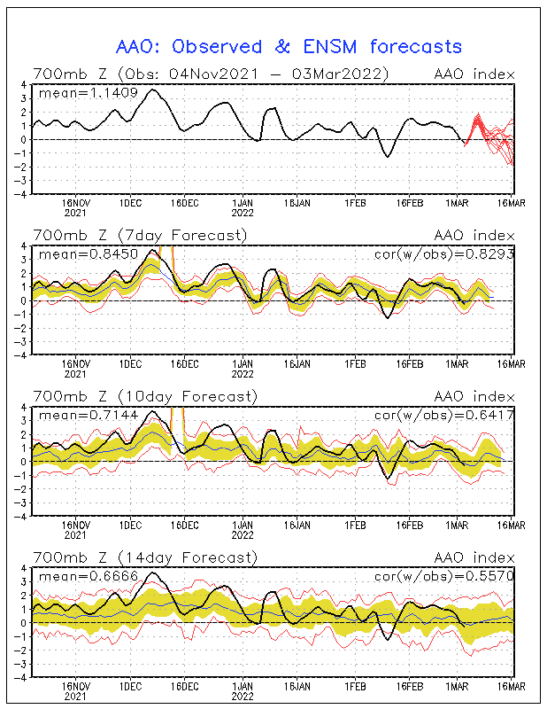
And now the forecast
The AO is related to the NAO so we might was well discuss that as well.
North Atlantic Oscillation (NAO)
The North Atlantic Oscillation (NAO) consists of two pressure centers in the North Atlantic: one is an area of low pressure typically located near Iceland, and the other an area of high pressure over the Azores (an island chain located in the eastern Atlantic Ocean). It is important to note that these two locations are most commonly used to measure the NAO, but studies have found that the pressure centers move around on a seasonal basis, and other locations have also been used for measuring this index. Fluctuations in the strength of these features significantly alters the alignment of the jet stream, especially over the eastern U.S., and ultimately affects temperature and precipitation distributions in this area. It is also important to note that the AO and NAO are two separate indices that are ultimately describing the same phenomenon of varying pressure gradients in the northern latitudes and the resultant effects on temperature and storm tracks across the continent.
Positive NAO
During a positive NAO there is a strengthening of the Icelandic low and Azores high. This strengthening results in an increased pressure gradient over the North Atlantic, which cause the westerlies to increase in strength. The increased westerlies allow cold air to drain off the North American continent rather than letting it build up and move south.
Above average geopotential heights are observed over the eastern U.S., which correlates to above average temperatures
The eastern U.S. often sees a wetter pattern with stronger storms during the winter season in this phase due to increased upper level winds
Negative NAO
A negative NAO indicates weakening of both the Icelandic low and Azores high, which decreases the pressure gradient across the North Atlantic. This decreased pressure gradient results in a slackening of the westerlies. The decrease in the westerlies allows cold air to build up over Canada, and this combined with below average heights (troughing) over the eastern U.S. gives the cold air a greater chance to move south and affect the eastern United States.
Below average geopotential heights are often observed over the eastern U.S. during the negative phase of the NAO, which correlates to below average temperatures
The eastern U.S. typically receives colder, drier air masses during the winter season in this phase
  |
Forecasting the Evolution of ENSO
Here is the latest NOAA forecast of Nino 3.4 temperature anomalies. This graphic does auto-update daily but changes slowly. You can see the “blue” newer model runs and the “red” older model runs. The Oceanic Niño Index (ONI) which is the three-month rolling average of the Nino 3.4 values is NOAA’s primary indicator for monitoring El Niño and La Niña. The secondary indicator is the Southern Oscillation Index (SOI) which compares the air pressure in Tahiti with the air pressure in Darwin Australia. It is a complicated formula and is intended to assess the response of the atmosphere to the changes in the pattern of warm and cool anomalies measured by the Nino 3.4 Index. It confirms rather than predicts the phases of ENSO.

Re The SOI

The below is first the early-month report from CPC/IRI which I call the reading of the tea leaves.in that it is based on a combination of model results and a survey of the views of meteorologists. Recently the early month analysis has been more favorable for a la Nina than the later in the month model-based analysis.

And now we have the more recent fully model based version .

There is not a lot of difference but the preference for La Nina conditions in NDJ is a bit less than a week earlier when the report was based mainly on a survey of meteorologist. When I see DJF I interpret that as J i.e. January as the J is the middle month in the DJF three month period. It is not a read clear indication that we are having a La Nina. .
Here is the recently released JAMSTEC Nino 3.4 Forecast.

Here is the Nino 3.4 report from the Australian BOM. It will update automatically on Tuesday morning or late Monday night. If it changes in a way that is significant, I will update this report to include a comment on the change.

Now the Comparison of the NOAA and JAMSTEC Forecasts. I am only discussing the differences for CONUS since NOAA does not cover the World in this set of forecasts. But the JAMSTEC World forecast is here for you to see:.
DJF 2016/2017
Temperature
JAMSTEC

NOAA
Precipitation
JAMSTEC

And then I extract an image for Europe on the left and CONUS on the right.
 |  |
NOAA
Here is one more forecast but it is not exactly the same months.
This is the precipitation forecast from Queensland Australia.

MAM 2017
Temperature
JAMSTEC

NOAA

Precipitation
JAMSTEC

NOAA

JJA 2017
Temperature
JAMSTEC

NOAA

Precipitation
JAMSTEC

NOAA

Conclusion


