
Written by Sig Silber
Updated at 12:15 AM EST January 2, 2019 to refocus the areas of most concern.
In this article we provide continuous updates for a variety of Weather and Weather Related Threats. One important group of threats are Mesoscale Events. A Mesoscale Event is smaller than a large scale or Synoptic Event like a major storm but larger than a micro-climate. Although they sometimes are forecast days in advance, they often spring up fairly quickly which is why we are publishing this report. We are also paying special attention to snow both as a threat but also of interest to those who travel based on snow conditions. And we also pay attention to travel conditions.
Special Attention this Week: Areas of most concern are now the Northwest including mountains and coastline in addition to possible flooding in the Southeast. The Southwest storm has played out.

Please share this article – Go to very top of page, right hand side for social media buttons.
You will see a number of different maps which are updated in real time, making this a “live” report. If a part of one or more of the maps shows an area that is highlighted, you can click on it and get the full current report. By having the reader click on these active situations rather than having GEI do so, you will not miss any events in which you might have an interest and which we had not noticed and the page will not get cluttered with warnings etc that have since expired.
Our focus here are events that are likely to last in the range of six hours but there can be longer or shorter events that are addressed by the Storm Prediction Center which is the main source of the information in this article.. Long-term major events like a Hurricane are more likely to be in a separate article. But that may not always be the case. Since in general, all the links on this page transfer you into the NOAA system, in order to get back into this article you need to either close the tab to which you were transferred or click back on the tab that has this article.
Overview: These Two Maps Provide Information but are NOT Set up to Provide More Detail. They should update daily but have not updated now for two days.

And Now the Day One and Two CONUS Forecasts
Day One CONUS Forecast | Day Two CONUS Forecast |
|
|
These graphics update and can be clicked on to enlarge. | |


include (“/home4/aleta/public_html/pages/weather/modules/500_Millibar_by_Day_Matrix.htm”); ?>
I have replaced a version of this graphic that was not updating with one that does. It is not as useful but does provide a different insight re the West Coast which is very important in the winter.

Here are the precipitation forecasts. First the cumulative for Days 1 – 3

Then cumulative for Days 1 – 7

Live Warning Maps which If Severe Weather is Shown can be Clicked on to Get More Detail about these events. I some cases we have been able to add a larger map to the standard map provided by SPC and other NOAA Agencies. Over time we expect to be able to find larger maps for all the warnings. But until then the smaller maps work fine as you are just looking to see if there is a current warning. If these is click on the map for additional information related to the event.
| WPC Met Watch |
| Current Mesoscale Precipitation Discussions (MPDs) |
 |
If there are green areas shown on this map, it means that there are currently or anticipated areas of severe weather events. Clicking on the U.S. map will take you to the MPD page at the NOAA where there is information on each of those mesoscale events. |
| Current Weather Watches | |
|---|---|
 | |
| This is the current graphic showing any severe thunderstorm and tornado watches which are in effect over the contiguous United States. Please read about the purpose of our watches for further information. Details on all valid watches may be found on our Current Convective Watches page. |  |
| Current Mesoscale Discussions | |
 | |
You need to click on the graphic above twice. Once to get to the NOAA site and another time to pick the region of interest. | |
 | |
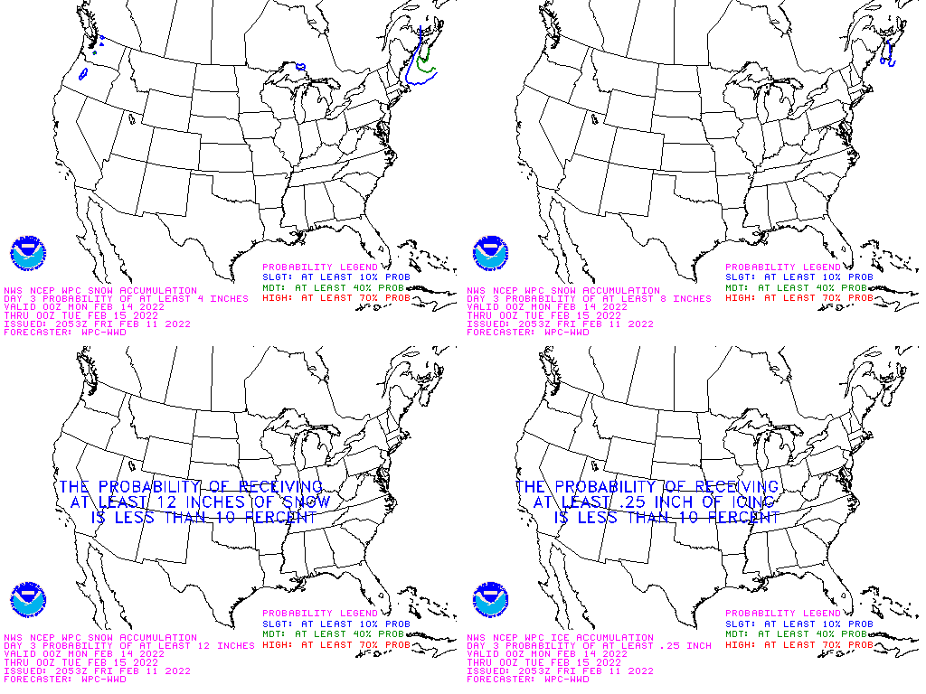
| Above Day I forecast for 4 inches or more snow. Below Day 3 composite forecast for having 4, 8, or 12 inches of new snow during the next 72 hours (possibly good for skiers) and a forecast for where there may be 1/4 inch of ice (travel risk). | |
 | |
| This is the current graphic showing any mesoscale discussions (MD’s) which are in effect over the contiguous United States. Please read the description of the purpose of our MD’s for further information. Details on all valid MD’s may be found on our Current Mesoscale Discussions page. |  |
| Convective Outlooks (We have plans to add larger maps but you should be able to see the area to click on with the current small maps) | |
| This is today’s forecast for organized severe thunderstorms over the contiguous United States. Please read the description of the risk categories for further information. You may find the latest Day 1 Outlook available as well as all Outlooks issued today online. | Today’s Outlook |
 | |
| This is tomorrow’s forecast for organized severe thunderstorms over the contiguous United States. Please read the description of the risk categories for further information. The latest Day 2 Outlook is available as well as all Outlooks that have been issued today. | Tomorrow’s Outlook |
 | |
| This is the day after tomorrow’s (day 3) forecast for organized severe thunderstorms over the contiguous United States. Please read the description of the risk categories for further information. The latest Day 3 Outlook is available as well as all Outlooks that have been issued today. | Day 3 Outlook |
 | |
| This is the day 4-8 forecast for organized severe thunderstorms over the contiguous United States. The latest Day 4-8 Outlook is available as well as all Outlooks that have been issued today. Note: A severe weather area depicted in the Day 4-8 period indicates a 30% or higher probability for severe thunderstorms (e.g. a 30% chance that a severe thunderstorm will occur within 25 miles of any point). | Day 4-8 Outlook |
 | |
| The Thunderstorm Outlooks depict the probability of thunderstorm across the contiguous United States in 4 or 8 hour time periods. The probabilistic forecast directly expresses the best estimate of a thunderstorm occurring within 12 miles of a point. The three probabilistic forecast thresholds are: 10, 40, and 70 percent. | Thunderstorm Outlook |
 | |
| Fire Weather Outlooks | |
| This is today’s forecast for organized wildfires over the contiguous United States. Please read the description of the risk categories for further information about this product. | Today’s Outlook |
 | |
| This is tomorrow’s forecast for organized wildfires over the contiguous United States. Please read the description of the risk categories for further information about this product. | Tomorrow’s Outlook |
 | |
| This is day 3-8 forecast for organized wildfires over the contiguous United States. Please read the description of the risk categories for further information about this product. | Day 3-8 Outlook |
 | |
| Watch, Warning and Advisory Links | |

| Current watches, warnings and advisories issued by the agencies of the National Weather Service. |
|


